
Pinellas Park ZIP Coverage
Pinellas Park has two principal residential delivery areas and one PO-box code, but its irregular annexed boundary reaches into many more ZIPs. Official GIS address points show where the municipal boundary and stored ZIP values intersect. They are not population counts. The figures do not mean each whole ZIP belongs to Pinellas Park, and they do not identify who occupies an address.
| ZIP Code | Areas Covered | Post Office | Notes |
|---|---|---|---|
| 33781 | Central and southern core | Pinellas Park retail station | 9,908 city-boundary address points |
| 33782 | Northern principal area | Pinellas Park delivery area | 8,532 city-boundary address points |
| 33773 | West and northwest fringe | Largo/Seminole postal geography | 1,716 city-boundary address points |
| 33762 | East and northeast fringe | Some Clearwater labels | 1,354 city-boundary address points |
| 33780 | PO boxes only | Pinellas Park retail station | No mapped delivery points |
Smaller intersections occur in 33709, 33777, 33760, 33716, 33764, 33702, 33708, 33710, and 33714. Those are pockets, not Pinellas Park-wide ZIP areas. Postal city labels inside the boundary include Pinellas Park, St Petersburg, Clearwater, Largo, and Seminole. The reverse is also true: a Pinellas Park mailing label does not by itself prove that an address is legally inside the city.
Pinellas Park Core ZIP Codes
Use 33781 as the central and southern Pinellas Park slice. It contains the civic and postal reference point, yet its code still extends beyond a simple neighborhood line. The northern principal slice is 33782. A PCPA Advanced Search can inventory parcels in either code and can then narrow the results by subdivision, tax district, property use, or the map viewport.
The official GIS count found 9,908 city-boundary address points in 33781 and 8,532 in 33782. That is a useful comparison of address geography, not a head count. Multiple people may share one delivery point, some parcels have no resident, and a person may receive mail somewhere other than the parcel situs. A careful ZIP code directory keeps those limits beside the numbers.
Pinellas Park PO-Box ZIP
ZIP 33780 is used for PO boxes, not a residential polygon. The city's own PO Box 1100 helps establish that use, while the city-boundary Master Address Point intersection shows zero delivery points for the code. It should never be described as a Pinellas Park neighborhood.
The Pinellas Park retail post office is at 5260 78th Avenue North, ZIP 33781-9998, with phone 727-548-7192. Posted research hours are weekdays 8:30 a.m. to 6 p.m. and Saturday 9 a.m. to 1 p.m., with a 24-hour box lobby. Verify current service details through USPS before a visit. For one street address, use the USPS lookup to confirm its delivery code rather than inferring it from a nearby parcel.
Pinellas Park ZIP Pockets
The clearest postal and municipal mismatch is 33773. GIS places 1,716 address points inside the Pinellas Park city boundary there, although the ZIP is also tied to Largo and Seminole postal geography. The 33762 intersection is almost as important, with 1,354 address points along the east and northeast fringe and some Clearwater labels.
Smaller east and north pockets sit in 33760, 33764, and 33716. Southern and southeastern intersections include 33709, 33702, 33710, and 33714, where St Petersburg postal labels are common. Western pockets reach 33777 and 33708 toward Seminole and Bay Pines postal geography. State the relationship as an intersection. Calling any whole fringe ZIP “Pinellas Park” would overstate the official evidence.
Find Pinellas Park Residents by ZIP
Finding residents by ZIP code requires a clear definition of the field being searched. PCPA Real Property Advanced Search can filter Owner & Location ZIP and export selected fields. Tangible Property has its own ZIP field, while the City Master Address Points layer queries a different set of features. An owner's mailing ZIP can differ from the parcel's site ZIP. State which one the result represents.
- Validate one delivery address through USPS. Keep its full street, city label, and ZIP.
- Run the ZIP in PCPA Advanced Search. Select fields that distinguish parcel situs, owner, tax-mail address, legal description, and tax district.
- Compare the output with the City Boundary and Master Address Point layers. Do not count every result as a resident.
- Use My Neighborhood for the exact address and confirm legal jurisdiction. Then narrow to a street or subdivision.
Once the code has been reduced to a street, the Pinellas Park street directory explains the address-level record chain. ZIP-level work should stop at geography and filtering rather than retelling that process.
Search Pinellas Park ZIP Records
PCPA Advanced Search is the most capable official ZIP-wide property tool. Beyond ZIP, it can include or exclude property uses, set living or gross square-foot ranges, narrow year built and acreage, choose waterfront or pool flags, and set sale type, date, and price. Subdivision and tax district help reduce a broad postal slice. Results can use predefined or custom columns, download in compressed form, and summarize value fields.
| Field group | ZIP-directory use | Important limit |
|---|---|---|
| Owner & Location ZIP | Filter a stored parcel location field | Do not confuse it with owner mailing ZIP |
| Subdivision / tax district | Narrow a code toward the city portion | Neither replaces the City Boundary layer |
| Property use | Separate broad use classes | Use does not identify an occupant |
| Custom output | Export parcel, site, legal, and date fields | Keep field names with the export |
The ZIP-capable PCPA property search is shown below.
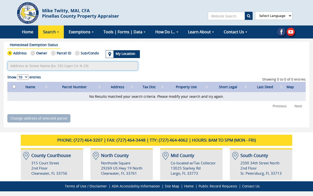
The controls show why a ZIP filter is just one layer in a parcel query, not a ready-made list of everyone in that postal area.
Read Pinellas Park ZIP Results
A parcel result may expose owner name, parcel number, site address, tax district, use, legal description, last deed, and map links. It may also show a mailing address. Matching site and mailing ZIPs can support an owner-occupancy lead, especially with homestead status, but it never lists every member of a household. A different mailing ZIP may simply reflect where tax notices go.
The PCPA property address and parcel search help shows the official routes into those records.
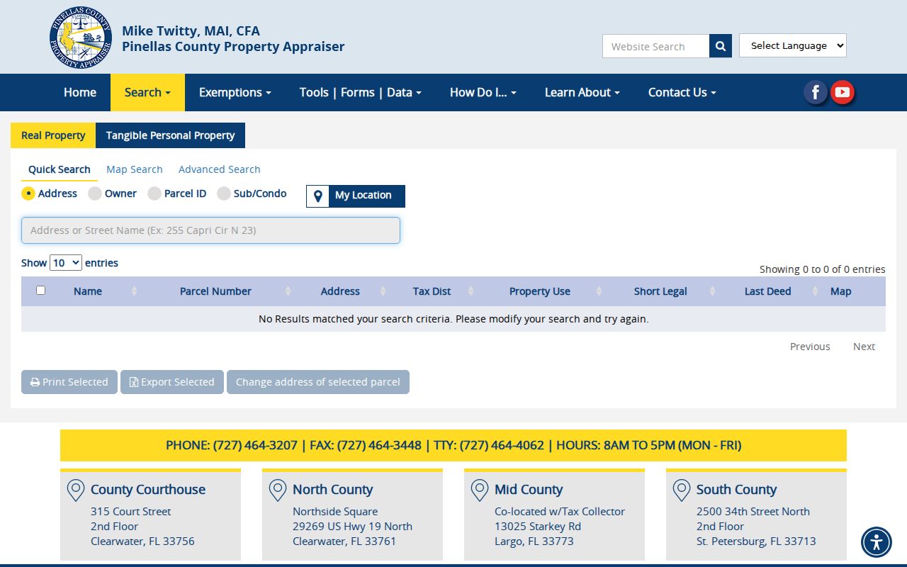
Keep the parcel ID with any saved ZIP result because it remains more stable than a street string.
The Pinellas property-tax lookup supplies another official address-based property channel.
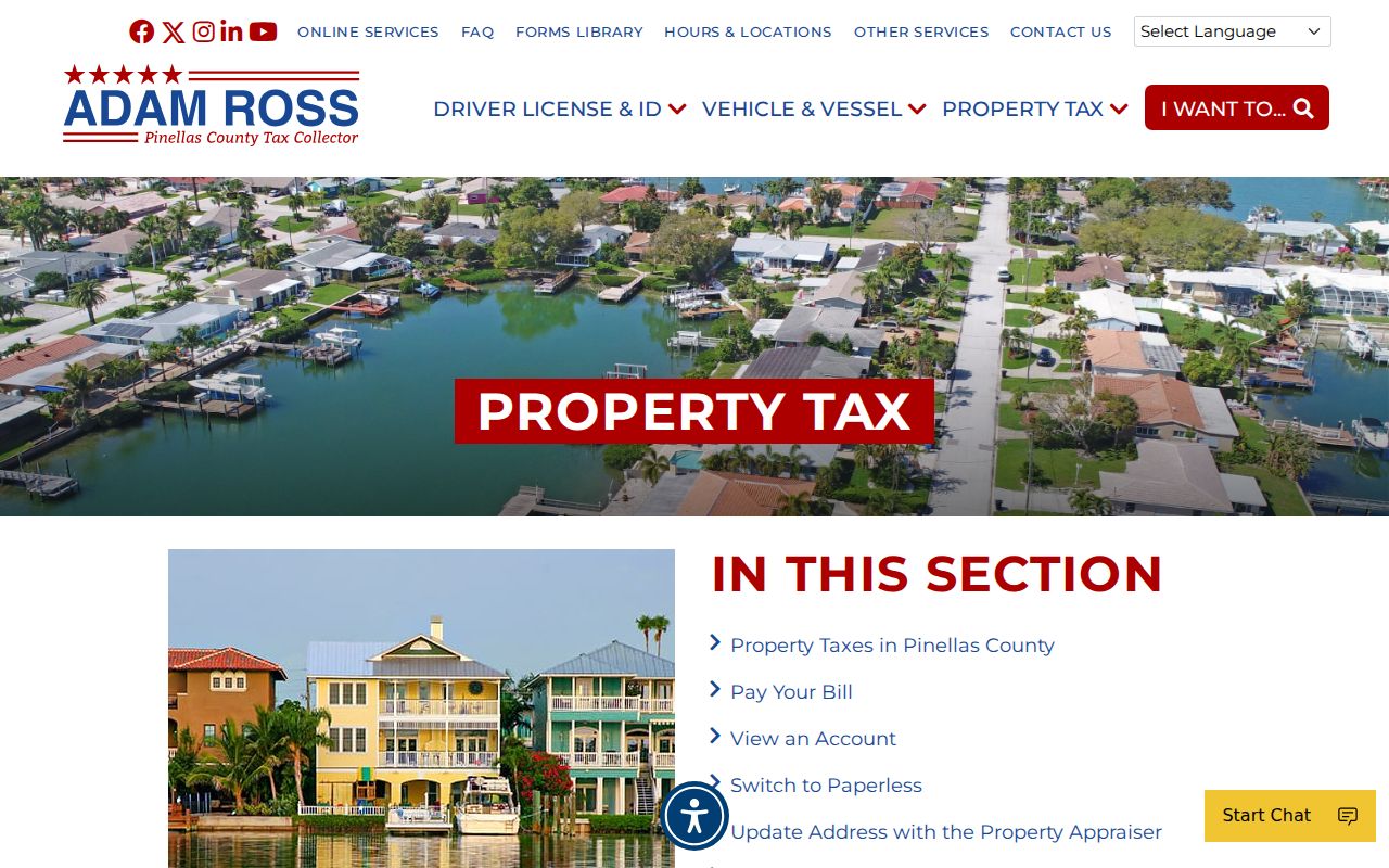
Tax records should be read as dated account and parcel evidence, never as a household roster.
Keep Pinellas Park Parcel Context
Street and postal labels can change while the underlying parcel remains the same. Pinellas records display a section-township-range-subdivision-block-lot identifier in the pattern 99-99-99-99999-999-9999. The legal description, subdivision block and lot, plat book and page, and official-record references help carry a search across an address change. That makes the parcel ID a sound control when a ZIP result has an unexpected city label.
City GIS also keeps the site address and site city-and-ZIP apart from the owner name and mailing lines. Preserve those field names when taking notes. If the owner mail goes to another code, report that as a tax-mail destination, not a new site location. Sales, land, building, and deed fields add dated property context, but none reveal every person at the address. Homestead status is stronger evidence that an owner claims a primary residence, though it still is not a household list.
Annexation records can explain why the same postal code spans Pinellas Park and a neighboring postal city. Their polygons may carry the ordinance number, approval date, recorded book and page, former zoning, parcel, year, and acreage. Those facts are more precise than guessing from the envelope. When the ZIP and city boundary seem to conflict, compare the parcel ID, legal description, Master Address Point, and annexation layer before drawing a conclusion.
Verify Pinellas Park Jurisdiction
Pinellas County's My Neighborhood tool asks for Street Address, City, and ZIP, then resolves local jurisdiction and services for that one address. It is the practical bridge between a postal label and city government. Next, compare the city boundary or annexation layer. Annexation polygons can show ordinance number, approval date, official-record book and page, former zoning, parcel, year, and acreage.
The My Neighborhood address check is shown below.
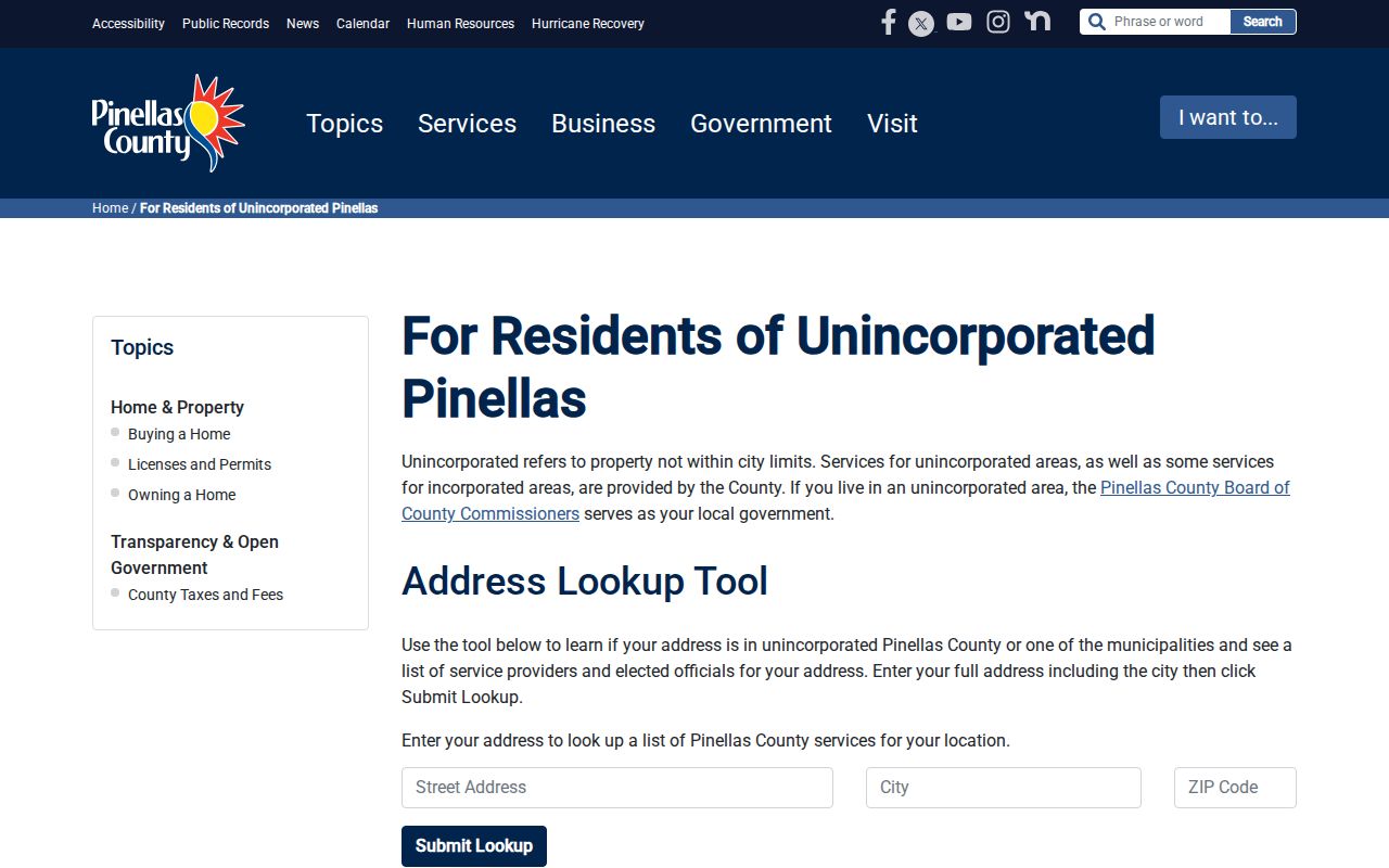
This address-first result is stronger jurisdiction evidence than the city name printed on mail.
Pinellas Park ZIPs Versus Limits
A Pinellas Park ZIP code directory describes mail geography, not municipal authority. USPS maintains delivery routes, while the city boundary follows incorporation and annexation. Census ZIP Code Tabulation Areas are generalized statistical polygons, not current USPS delivery boundaries. These systems can overlap without error because they serve different purposes.
The safe chain is simple: USPS confirms delivery for one address, My Neighborhood identifies local jurisdiction and services, city GIS explains a boundary or annexation, and Census ZCTA supports broad statistics. No verified local ZIP split year or ZIP-specific voter or population count was found. Do not invent one or convert address-point totals into residents.
- ZIP vs ZIP+4
- A ZIP is the five-digit delivery area; ZIP+4 narrows a delivery segment.
- PO-box ZIP
- A code used for post-office boxes rather than mapped street delivery points.
- Unique ZIP
- A code assigned to one large organization or recipient. No Pinellas Park example was verified.
- Carrier route
- A USPS delivery path within a ZIP, which is not a city or neighborhood border.
Boundary check. Treat every fringe ZIP as an intersection with Pinellas Park, then verify the exact parcel before stating its city.